The Bhutanese Leading the way.
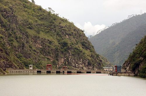
As climate change accelerates the melting of Himalayan glaciers and extreme weather across the region, Bhutan is facing heightened scrutiny over the vulnerability of its mega hydropower projects situated along hazard-prone river basins.
With memories of catastrophic glacial lake outburst floods (GLOFs) in neighboring countries underscoring the stakes, the Ministry of Energy and Natural Resources (MoENR) has detailed a multi-layered defense strategy, from rigorous engineering safeguards to real-time early warning networks.
Addressing concerns over climate-induced risks such as flash floods, cloudbursts, and GLOFs, Minister for MoENR, Lyonpo Sonam Tashi, emphasized that safety is woven into the very fabric of the country’s primary economic engine rather than treated as an afterthought.
“We cannot eliminate natural hazards; we can ensure our infrastructure is designed for extreme conditions, hazards are continuously monitored, warnings reach people in time, and clear emergency response plans are in place,” Lyonpo stated. “Therefore, as we develop Bhutan’s hydropower resources, we do not treat safety as an afterthought. We build it into the planning, design, monitoring, and operation of our projects.”
Engineering for the “Probable Maximum Flood”
Bhutan’s experience with hydropower dam safety spans decades, evolving from earlier projects like Chukha, Kurichhu, and Tala HPPs to modern, highly complex installations. Because historical river discharge and climate monitoring data in Bhutan largely date back only to the early 1990s, project planners bypass limited domestic records by utilizing regional historical extreme rainfall events and advanced hydrological methods to determine design flood values.
Major hydraulic structures are engineered to safely accommodate extreme design scenarios, including the Probable Maximum Flood (PMF), in strict compliance with national hydropower and dam safety guidelines. Meanwhile, smaller diversion structures like barrages and weirs factor in a minimum 100-year flood return period.
Comprehensive hazard assessments and downstream mapping
Under the Detailed Project Report (DPR) process, multi-disciplinary teams assess potentially hazardous glacial lakes and model GLOF propagation from source zones down to project dam sites. These models help calculate potential flood levels, arrival times, and structural impacts, directly dictating safety requirements such as spillway capacities.
While phenomena like Landslide Dam Outburst Floods (LDOFs) remain difficult to precisely quantify due to high uncertainty in timing and magnitude, site-specific investigations are deployed to evaluate vulnerability. Crucially, the scope of risk assessment extends far beyond the dam wall itself; dam break assessments and downstream floodplain mapping are integrated into the DPR study to scope out downstream consequences and shape local risk-mitigation frameworks.
Operational surveillance and real-time monitoring
Mitigation does not conclude once a facility is commissioned. Bhutan enforces mandatory Dam Safety Guidelines requiring formal safety inspections by a designated Dam Safety Team twice a year. This ongoing surveillance ensures that infrastructure performance is continually evaluated against aging indicators and evolving climate data.
To bridge the gap between slow-onset environmental shifts and sudden emergencies, project authorities and the Druk Green Power Corporation Limited (DGPC) maintain close coordination with the National Center for Hydrology and Meteorology (NCHM).
Real-time Early Warning Systems (EWS) are operational across vulnerable basins such as Mangdechhu, Chamkharchhu, and Punatsangchhu (Phochhu and Mochhu). Supported by approximately 30 real-time water level monitoring stations outfitted with alert thresholds across major rivers, the network feeds critical data to dam operators and local authorities.
Coordinated emergency response
When a significant flood or GLOF is detected or forecasted, multi-agency contingency frameworks kick into gear. Integrating NCHM monitoring data, local administrations, disaster management authorities, and plant operators, these protocols aim to translate early warnings into immediate operational actions and downstream community alerts.
As climate projections signal an increasingly volatile cryosphere, MoENR maintains that Bhutan’s long-term resilience relies on dynamic adaptation by continually updating design assumptions, strengthening monitoring tech, and fostering close coordination between the Government, DGPC, and vulnerable downstream communities to anticipate and weather future extremes.