The Bhutanese Leading the way.
Bhutan’s high-altitude landscape is changing at a startling pace as the climate warms. During the press briefing session, the National Centre for Hydrology and Meteorology (NCHM) presented the state of the nation’s ice and water.
These records show that while new lakes are appearing across the mountains, the country’s ancient glaciers are rapidly vanishing.
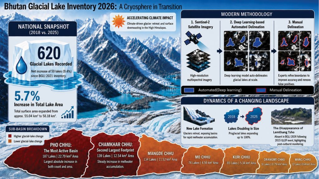
Bhutan now has 620 glacial lakes. This is a 9.4% increase (more than 50 new lakes) from the 567 lakes recorded just five years ago.
Phuntsho Tshering, an official from the Cryosphere Service Division, noted that this transformation reflects a direct response to a warming world. “Bhutan’s glacierized Himalayan landscapes are undergoing rapid transformation due to climate change,” he stated.
The total area covered by these lakes has expanded to 58.18 square kilometres. Much of this growth is happening in the Pho Chhu sub-basin. It remains the most dynamic region in the country, with 187 lakes. Some existing lakes in these high-altitude basins have even doubled in size.
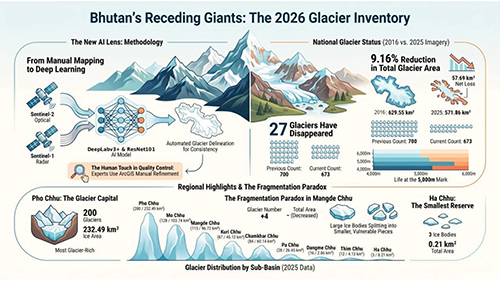
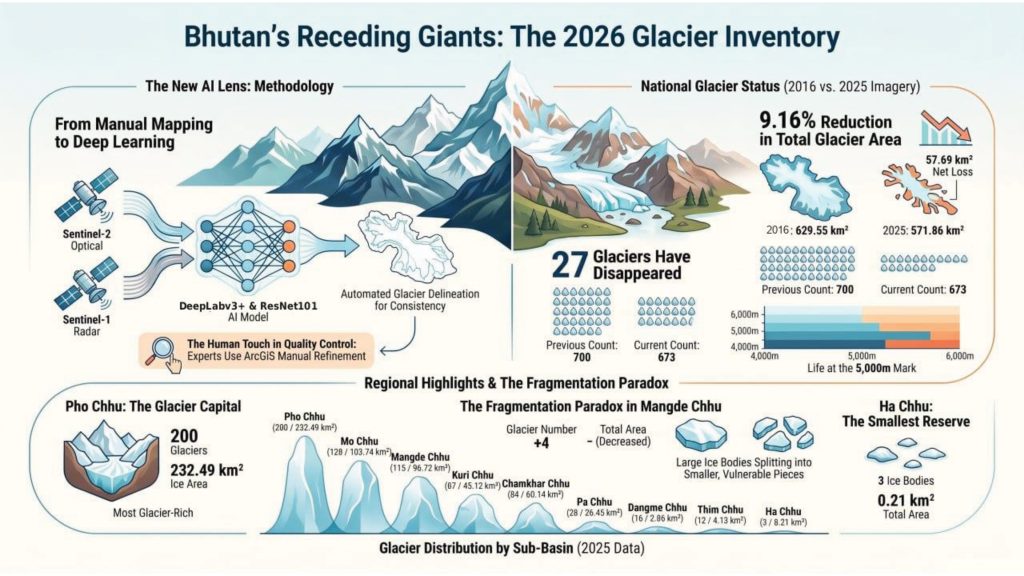
While the water rises, the glaciers are steadily shrinking. Bhutan has lost 27 glaciers since the last major assessment in 2018. The total glacier area dropped by 57.69 square kilometres over the last nine years. This represents a loss of 9% of the nation’s total glacier cover.
Phuntsho Tshering explained that the findings highlight the ongoing retreat and fragmentation of glaciers across Bhutan’s Himalayan landscape.
In some areas, larger glaciers are breaking apart into smaller pieces. This fragmentation actually increased the number of glaciers in the Mangde Chhu basin despite the overall loss of ice. Most of the remaining glacier area now lies between 5,000 and 5,700 metres above sea level.
The disappearing ice and growing lakes create a significant risk for those living downstream. The absence of Lemthang Tsho from the new records serves as a stark reminder of these dangers.
That lake disappeared from the map following a major outburst flood in 2015. The NCHM warned that the continued expansion of other lakes underscores the need for intensified monitoring.
Officials used advanced Sentinel-2 satellite imagery and deep learning models to create these inventories. They said this inventory represents a major methodological advancement over previous manual approaches. This new technology ensures that the data used for national planning is highly accurate.
NCHM plans to update these records every five years. This consistent monitoring is vital for disaster risk reduction and managing the country’s water resources.
Protecting mountain communities and hydropower interests remains the top priority as the cryosphere continues to shift.